EXPLANATION OF A BOUNDARY SURVEY - Our Process
CONFERENCE
The client must at some time, explain what he is requesting to have done, or what his problem is. This may take considerable time
ESTIMATE
Once the client has discussed with the surveyor his requests or problems, the surveyor must review enough information to have a reasonable understanding of the problems related to the location of the property in question. Depending upon the surveyors knowledge of the area, the amount of records which he has accumulated that relate to the proposed project and limited descriptions and related maps, he will estimate the amount of time he feels that each type of work, which are listed below, will be required to complete the survey..
RESEARCH
Before any work is attempted, some knowledge of the legal boundaries of the property and adjoining properties must be had. Unless the client furnishes the proper documents, it is necessary for the surveyor to research the public and private repositories for the required information. This involves research time, in extreme cases several days. Having this data in hand, the surveyor will begin to review the aquired documents for consistency and reference to monuments of public record. The surveyor will then search public, and private records to find data as to the location and description of physical monuments on which the descriptions are based.
EVIDENCE
The monuments inferred to (Lot "X" of the Plat of "Y") or referred to (Commencing at the Northeast corner of Section "Z" or to the Southwest corner of tract described in Auditor’s File Number *****) in the description must be found so that the required measurements may be taken from them. Additional research is conducted in searching public records for mention of the required monuments, type of monument and location of monuments. The surveyor then visits the perceived location in the field in order to determine that the required monuments are available for use. At this point, it is not unusual to find that some of the monuments have been destroyed, moved, or do not correspond with public record description. This inturn requires additional evidence to be recovered.
MEASUREMENTS
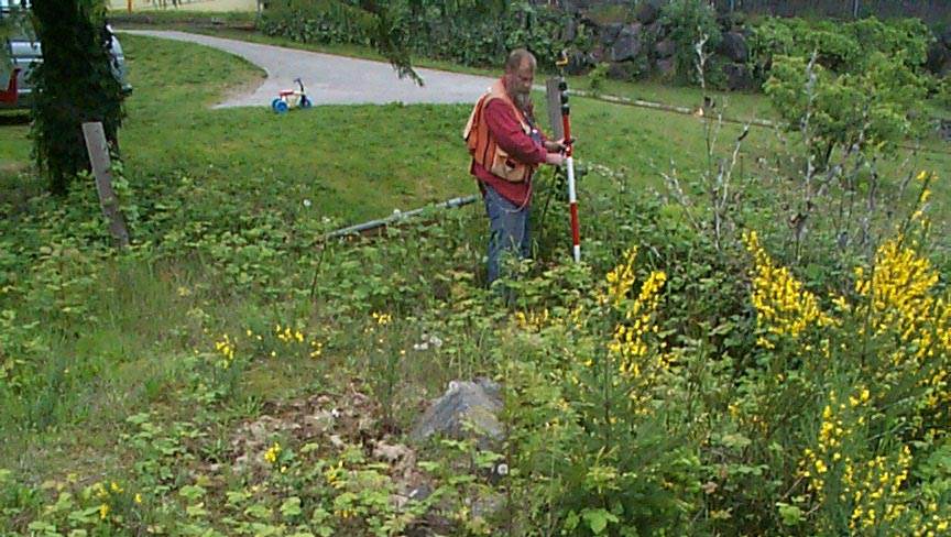
The field party is then sent to secure measurements to and check between the found monuments required for the project. The field crew then extends the control from the found monuments to and thru the project site in preparation for staking of the boundaries. In most cases it is not possible to complete a project at this stage, so the field party returns their findings to the office.
COMPUTATIONS
Field notes prepared by the field party during the work conducted in the measurements phase above, which consist of measurements of horizontal and vertical angles, distances, descriptions of located monuments, location of physical features must be reduced to bearings, horizontal distance and X,Y positions before they can be evaluated. This involves mathematical computations in the office and the results must be plotted on a map for use. Concurrently with the reduction of the field notes the legal description of the project property and adjoining properties and public record information of controlling monuments is computed to there X,Y position.
INVESTIGATION
The data and evidence found which has been computed and assembled is then compared with matters of record, such as deeds, plats, recorded records of surveys and old surveys not of record etc. In may cases, there are defects in the records, such as overlaps, gaps, erroneous or contradictory distances, missing data (monuments) etc.
SOLUTION
The surveyor after reviewing the computation and comparison thru the above investigation must determine what will be required to complete the survey. The surveyor may converse with title companies, attorneys, public agencies, adjoining property owners and other surveyors regarding knowledge of the conditions encountered with the survey. Upon resolution of any conflicts, missing information related to deeds, monuments and occupations line to the satisfaction of the surveyor he then concludes as to the location of the property. The required computations are then prepared to enable the field party to set the required corners and points on the boundary lines as requested by the client.
SETTING CORNERS AND LINES
The field party returns to the project site and establishes the corners and lines from the previously established control points. The field party in the process of establishing the boundary of the property, notes the location of existing physical features which may be pertinent to the occupied property lines. THIS OFTEN IS THE FIRST TIME THAT THE CLIENT SEES ANYONE ON THE JOB, AND HE MAY BE SURPRISED TO SEE HOW QUICKLY THE WORK PROCEEDS.
RECORDS
Upon completion of the survey, a record must be made. The surveyor is required by law to file certain records in the County Auditor’s Office. These records and their contents are required to comply to various requirements of law. Often maps and descriptions are required by the client. All of this requires time to produce.
REPORTS
Very frequently the client will need explanations or advise concerning the location of the surveyed boundary of the property in relationship to the occupied boundaries, or an attorney or title company will require information as to the findings of the survey. Often clients request detailed statements of charges for the survey fees, but such detail is not meaningful to most people unless they understand the situation as outlined herein.
ACTUAL COST
Upon completion of the various types of work conducted above to the surveyor satisfaction, the map recorded, the records indexed and put away, the surveyor will then and only then be able to tell you what it costs to complete the project that was requested by the client. The less the surveyor knows about the local color of the area, the growth and construction or improvements being conducted on or near the location of the controlling monuments, the ambiguities in the descriptions or plat maps required for the boundary location the farther away from the truth the estimated cost will be.


